Ashby museum has an archive of over 3000 photographs – both original and copies. This page allows people to view the main group of photographs, but does not include photographs in specialist collections as these often include ones that are not in our primary area of interest. Larger images may be viewed at the museum during opening hours, and copies for private use may be purchased.
This page also allows access to details of artefacts (physical objects) held by the museum. Please note that when changing between photographs and artefacts, the classification list is only updated after the first search.
Showing images 1901 to 1910 of 4081
AYZMU:P12-0567
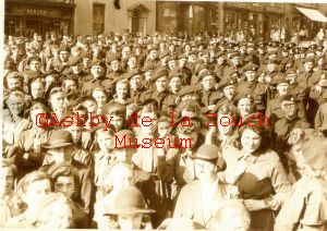
1940 - 1942
Military parade gathering in 1940-42. Businesses identified - Left hand side: No.53 Bullens (grocers) then No.55, C.J. Lewis (printers) - formerly Barker and Lewis, No.57 Bullen & Glover (chemist)
AYZMU:P12-0566
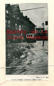
1925 & 1932
Either 1925 or 1932 flood. Looking towards Kilwardby Street.
Businesses identified: On left Brown (book shop and printers),
Williscroft (shoes), Lloyds Bank. Facing, on Kilwardby St:
Shellbrook Motors (toys). Note Pearl Assurance sign in front of
first floor windows, Shoulder of Mutton (public house).
AYZMU:P12-0565 image 1 of 2
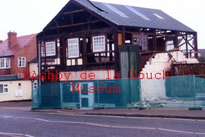
2008
Demolition of buildings (occupied by Holdrons until closure, then The Bed Shop) opposite Co-op supermarket in 2008. Redeveloped into residential apartments above and retail units below (currently Decorating Centre, Accountants and Ask italian resturant)
AYZMU:P12-0565 image 2 of 2
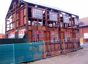
2008
Demolition of buildings (occupied by Holdrons until closure, then The Bed Shop) opposite Co-op supermarket in 2008. Redeveloped into residential apartments above and retail units below (currently Decorating Centre, Accountants and Ask italian resturant)
AYZMU:P12-0564
1900 - 1920
Pathway leading up to Smisby St. James church (just see top of church on right) Date unknown - probably 1900-1920's
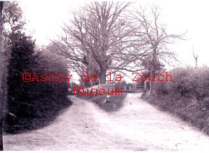
AYZMU:P12-0563
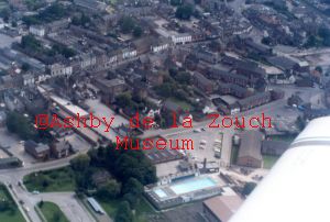
1987
Aerial photo showing North Street running across middle of photo. Leisure centre and open air swimming at bottom centre, with North Street school and Ivanhoe headmaster's house to left. Circle garage on Derby Road still visible, which was demolished in 1987 ready for building of Fine Fare (supermarket) which opened in 1988.
AYZMU:P12-0562
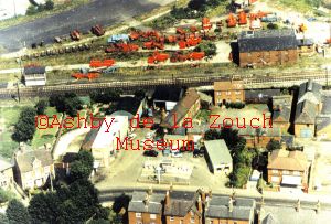
1960 - 1965
Aerial photo showing Tamworth Road along bottom of picture with Woodhouse motor garage towards left (now residential apartments), with Tamworth post office (now an Indian resturant) to the right. The Maltings are behind the garage, with the Leicester to Burton light railway running across picture behind. Agricultural vehicles stored on site of old branch line and platform (which was taken up in 1955)
AYZMU:P12-0561
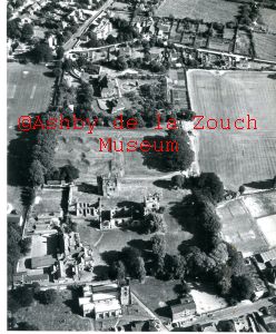
1960 - 1969
Aerial photo looking over top of South Street, St. Helen's church, castle. Leicester Road, Upper Packington Road area showing Manor House, Boy's Grammar school playing fields.
AYZMU:P12-0560
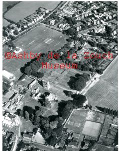
1960 - 1969
Aerial photo looking over top of South Street, St. Helen's church, castle. Leicester Road, Upper Packington Road area showing Manor House, Boy's Grammar school playing fields.
AYZMU:P12-0559
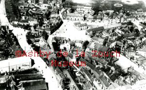
1927 (pre)
Aerial photo of Derby Road and The Green. Tramway tracks and
poles are visible. Trams finished in 1927 so photo pre 1927.
Note: Mill Bank, large square building to north of the Plough
(public house) was the original Primitive Methodist chapel. See also P10-0728