Ashby museum has an archive of over 3000 photographs – both original and copies. This page allows people to view the main group of photographs, but does not include photographs in specialist collections as these often include ones that are not in our primary area of interest. Larger images may be viewed at the museum during opening hours, and copies for private use may be purchased.
This page also allows access to details of artefacts (physical objects) held by the museum. Please note that when changing between photographs and artefacts, the classification list is only updated after the first search.
Showing images 3461 to 3470 of 4081
AYZMU:P09-0541
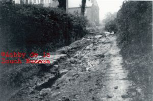
1925 - 1932
Footpath, with Gilliwiskaw brook to left, leading towards the
Don opening which leads to Smisby Road. Top end of Hood Park.
Flood of either 1925 or 1932.
AYZMU:P09-0540
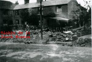
1925 - 1932
Properties on left hand side of North Street, looking up road.
Demolished in 1950's, and now site of Ashby Health Centre
approximately. Flood damage (1925 or 1932)
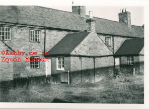
AYZMU:P09-0539
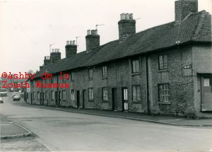
1976 - 1979
Row of cottages at bottom of North Street, opposite the present
Health Centre and The Green. Were built in 1820's or 30's, and
were demolished in the late 1970's for the Claridge Place
development. (See also P09-0539). Property on extreme right
used to be Joey Staley's shop (sold anything!)
AYZMU:P09-0538
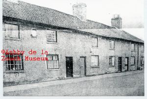
1976 - 1979
Row of cottages at bottom of North Street, opposite the present
Health Centre and The Green. Were built in 1820's or 30's, and
were demolished in the late 1970's for the Claridge Place
development. (See also P09-0539)
AYZMU:P09-0537
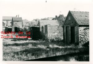
1976 - 1979
Bottom of gardens with outside toilets, rear of properties at
bottom of North Street, opposite the present Health Centre.
Were built in 1820's or 30's, and were demolished in the late
1970's for the Claridge Place development. (See also P09-0536)
AYZMU:P09-0536
1976 - 1979
Rear of properties at bottom of North Street, opposite the
present Health Centre. Were built in 1820's or 30's, and were
demolished in the late 1970's for the Claridge Place
development. (See also P09-0537)
AYZMU:P09-0535
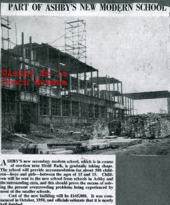
1952
Building of the new Secondary Modern School (Ivanhoe School).
AYZMU:P09-0534
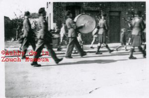
1945 - 1950
Procession, marching up North Street Left hand side, looking up
North Street. Property in background demolished in 1950's and
site is now where Ashby Health Centre is built (see also
P09-0517). Marchers with bagpipes and kilts. Children in short
trousers - therefore possibly taken in 1940's or 50's. Occasion
not known.
AYZMU:P09-0533
1980 - 1985
Mill Lane looking towards Market Street, just past vehicular
entrance to Bullens courtyard. Mews Tea shop on left in
foreground.
AYZMU:P09-0532
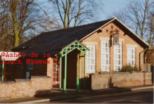
1980 - 1989
Ashby museum, prior to the 2007 extension. Possibly taken in
the 1980's.