Ashby museum has an archive of over 3000 photographs – both original and copies. This page allows people to view the main group of photographs, but does not include photographs in specialist collections as these often include ones that are not in our primary area of interest. Larger images may be viewed at the museum during opening hours, and copies for private use may be purchased.
This page also allows access to details of artefacts (physical objects) held by the museum. Please note that when changing between photographs and artefacts, the classification list is only updated after the first search.
Showing images 511 to 520 of 4081
AYZMU:P16-0020
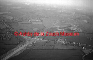
1988
Aerial view of Ashby in 1988. Line of the A42 under construction, running left to right (south to north) diagonally. The Railway line runs across middle view. Leicester Road (then the A50, now the A511) runs bottom right (buildings are New Packington) to top left. Town of Ashby to the left.
AYZMU:P16-0019
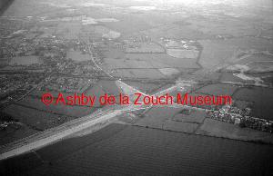
1988
Aerial view of Ashby in 1988. Line of the A42 under construction, running left to right (south to north) diagonally. The Railway line runs across middle view. Leicester Road (then the A50, now the A511) runs bottom right (buildings are New Packington) to top left.
AYZMU:P16-0018
1988
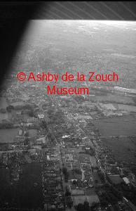
Aerial view of Ashby in 1988. Foreground is Smisby Road with the soap factory buildings and Hood Park adjacent. Market Street runs diagonally across the photo.
AYZMU:P16-0017
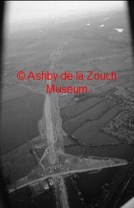
1988
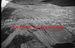
Aerial view of of the A42 under construction in 1988. Leicester Road bridge under construction, with the bridge over Upper Packington Road in the middle distance. Ashby town to the right.
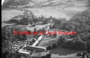
AYZMU:P16-0016
1988
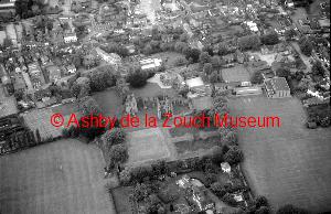
Aerial view of Ashby in 1988. Castle in foreground. Manor House school and grounds behind, and St. Helen's church.
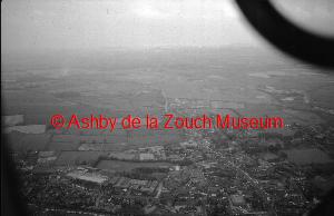
AYZMU:P16-0015
1988
Aerial view of Ashby in 1988.
AYZMU:P16-0014
1988
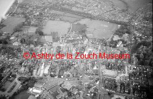
Aerial view of Ashby in 1988 looking south - larger "green area" at top is the Bath Grounds.
AYZMU:P16-0013
1988
Aerial view of Snibston pit in 1988.
AYZMU:P16-0012
1988
Aerial view of the Coleorton area in 1988.
AYZMU:P16-0011

1994
Aerial view of the Coleorton area in 1994.